Topsail Beach Photographer -- About Topsail Island NC
We are so fortunate to have visitors from all over the country visit us here at Topsail Island! This summer, many families have told me they travel to our little 26 mile barrier island every single year, and many others have said it was their first time ever here.

So WELCOME! (Or welcome back!!)
For those that are new to the beaches of Topsail, or maybe haven’t visited us in many years, I thought it might be useful to give a little information about the island…so here ya go:
First of all, the name is pronounced TopSUL. Yes, I promise, it really is!
We can always tell who might not be from around here or who isn’t familiar with us when we hear them say “top sail”—that’s not a bad thing at all, it just isn’t correct. Forget what logic tells you, and know the name is topSUL. So it’s topSUL Beach, and North topSUL beach, and topSUL drive, and topSUL island (you get the idea!).
Legend has it that the name comes from the accent of British sailors who would scream out “Topsail!” (pronounced like “topsul!”) when they would see the tops of the sails of feared pirate ships hiding in the channels. The coastline of North Carolina was a pretty famous pirate haunt due to its natural string of barrier islands that provided cover for them, so the legend of the British sailor giving us our name is pretty believable and is definitely the story I’ve heard all my life. I’m not sure if the legend is completely accurate but it makes sense that the island would be called Topsail if sailors often saw the tops of pirate sails lying in wait here—it was probably called Topsail as a reminder to be careful sailing off the coast here. Supposedly Blackbeard even hid some of his treasure in Topsail, but that has never been confirmed as far as I know.

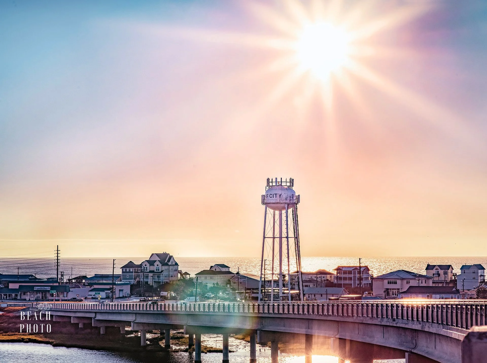
Topsail Island is 26 miles long and is comprised of 3 municipalities: North Topsail Beach (north end), Surf City (middle of the island), and Topsail Beach (south end). While there is no “south Topsail Beach” per se, you might hear people referring to it that way. It can be a bit confusing to those who think of Topsail Beach as the whole island, however, the southern end of the island is actually the town of Topsail Beach, so it’s most accurate to only call the south end Topsail Beach.
There are two bridges connecting the island to the mainland: the Surf City Bridge in the middle of the island and the North Topsail beach bridge on the north end. The bridge in Surf City has a roundabout at either end to keep traffic flowing (that concept is questionable at times!), and also has an awesome pedestrian walkway that is separated from vehicle traffic by a concrete barrier and a great way to get sweeping vistas of the island, the intracoastal waterway and the ocean all at once. You cannot casually, or safely, walk over the bridge in North Topsail—it is older and wasn’t built with bike or pedestrian lanes.
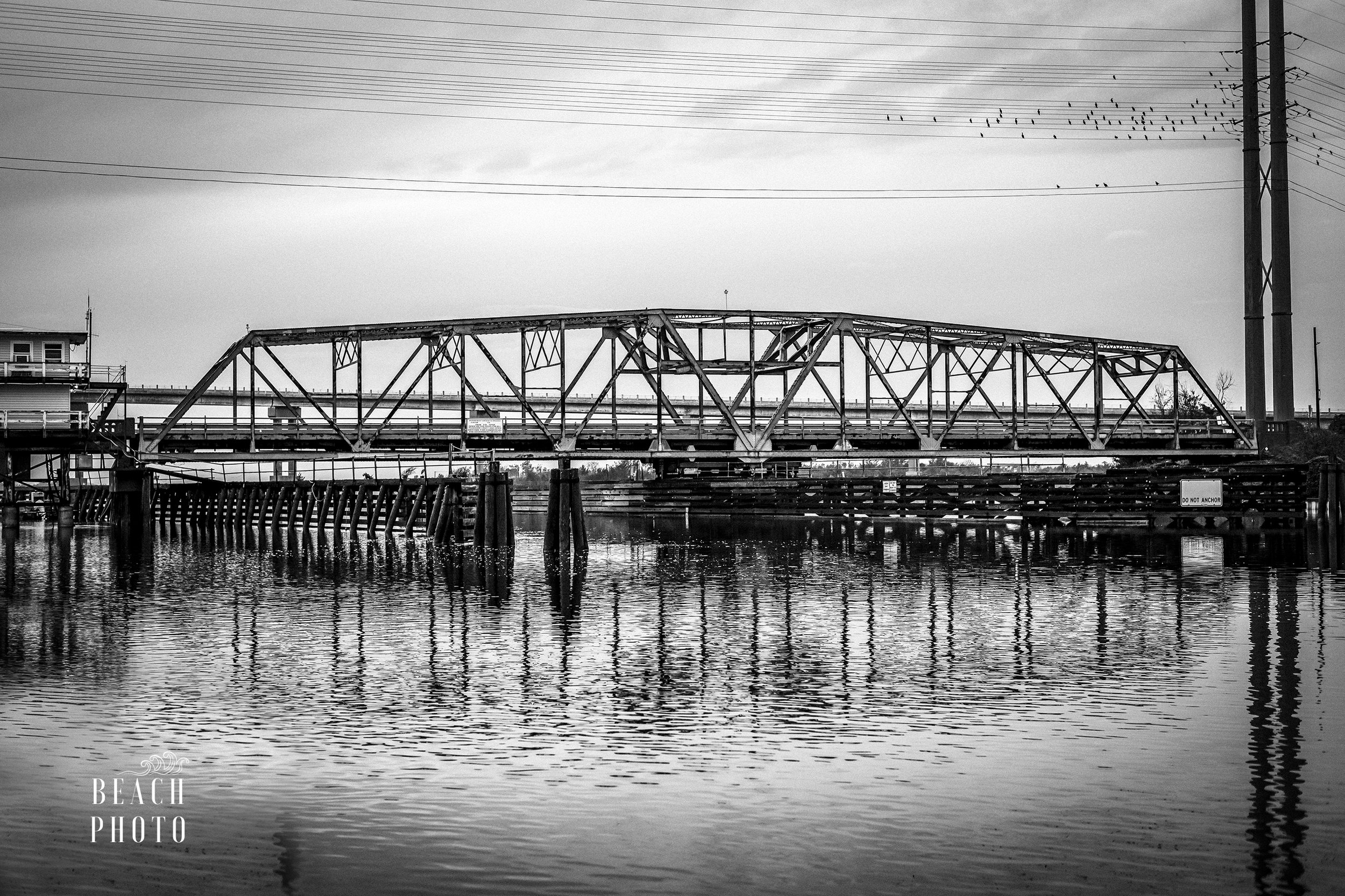
Many tears were shed as the old swing bridge in Surf City was dismantled in 2018 after the new bridge was built, and the old swing bridge is definitely missed. As a resident here, it was bittersweet to see it go for sure! It really, really, did stink to get stuck at the bridge if you needed to be somewhere though—it usually took about 15 minutes for the bridge to swing open, let boats pass through, swing back, and then for traffic to clear up. I do not miss being stuck before I had to be somewhere on time, but I also don’t have a great excuse for being late anymore! To me, the pedestrian walkway on the new bridge makes up for losing the nostalgia of the swing bridge—it is such a beautiful walk.
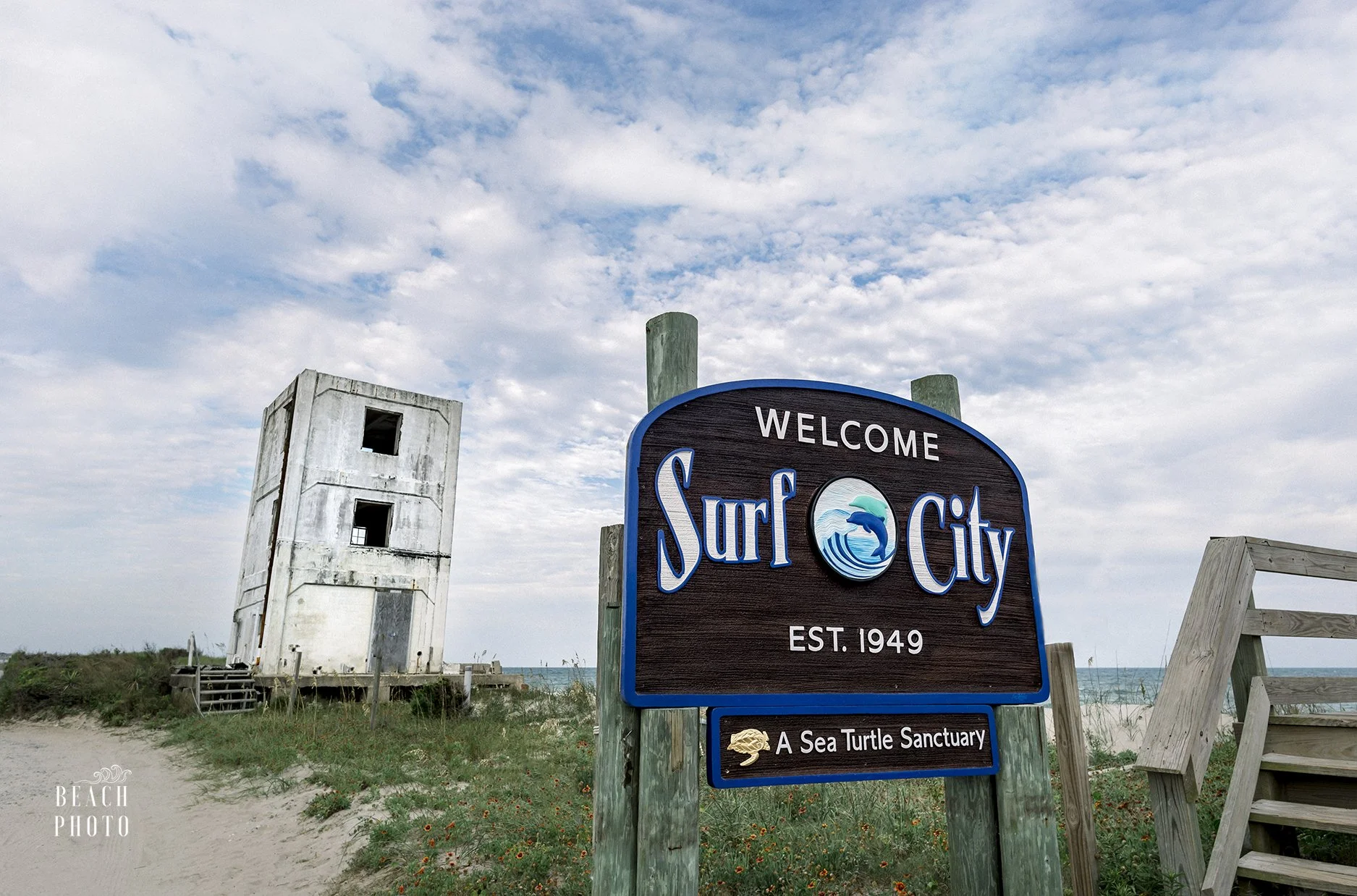
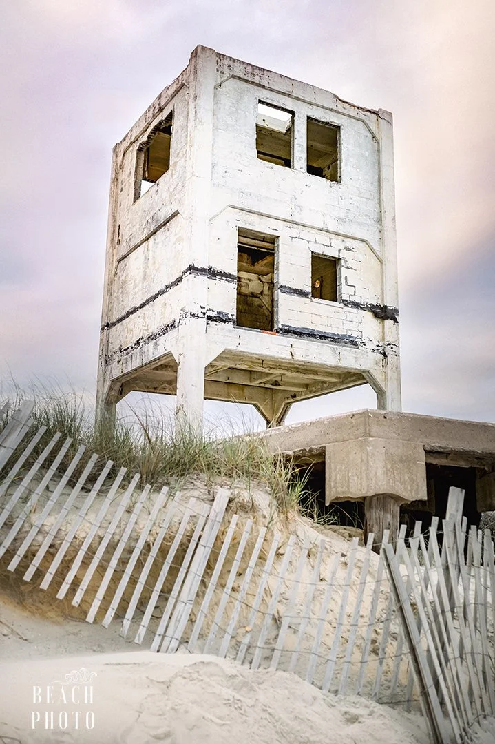
As you travel through the island, you may notice several odd looking concrete structures throughout. These are all part of Operation Bumblebee, a 1940’s secret military operation to try to bolster the nation’s anti-aircraft defenses shortly after the Second World War. The towers were used for guided missile testing, and those tests were part of the first US missile testing and helped pave the way for some of the technology used today.
Often our aircraft carriers would fall under attack before the planes that were attacking them were in range of the anti-aircraft guns, and led to huge losses during the war. Thus, the US Navy launched Operation Bumblebee, and by 1947, Topsail Island became the permanent home to Bumblebee tests and launches. You can find out more about the Topsail Towers and their role in the top secret operation at the Topsail Missiles and More Museum in Topsail Beach. The museum is actually housed in the historic Assembly building which served as a research facility for Bumblebee.
A few of the towers stand alone; a stoic relic of a time long past. Others have been converted into homes (talk about hurricane proofing!) or restored as the one located in the heart of Topsail Beach is. You can easily spot a tower at the Surf City/Topsail Beach border on the south end of the island (there is a public beach access right there with limited parking), and also just north of the Surf City/North Topsail Beach border (no public beach access here but it’s not too far of a walk from the nearest access).